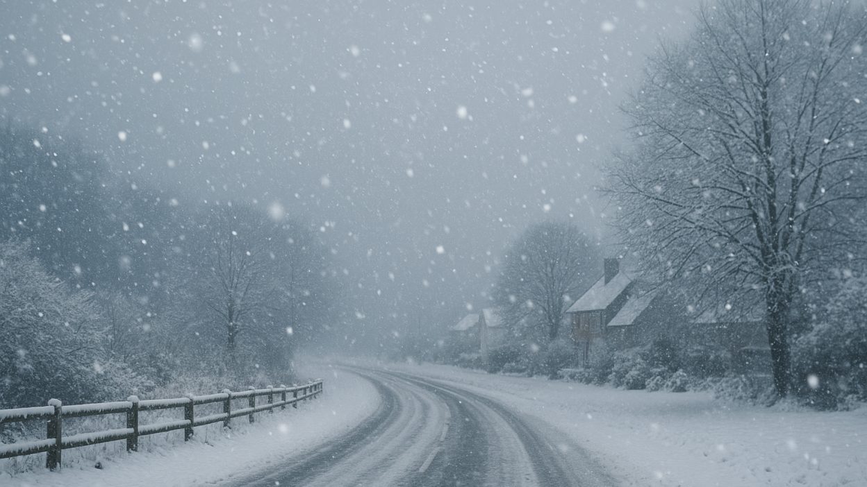
The UK is entering one of its most disruptive early-winter spells in recent years, as a powerful Arctic air mass pushes south and brings heavy snow, severe wind chill and treacherous ice to large parts of the country. Weather alerts have already been issued across Scotland, northern England, Wales and exposed coastal regions, with forecasters warning of worsening conditions through the week.
For millions of people watching the first major cold snap unfold, the headline “UK braced for significant snowstorm bringing potential White Christmas” is more than a seasonal curiosity. It raises serious questions about travel, safety, heating costs — and the realistic possibility that Christmas Day could finally deliver the snowy scenes many associate with a traditional British winter.
This article offers a clear, expert-led breakdown of the incoming weather pattern, regional impacts, public safety guidance, and what early-season snowfall may mean for festive forecasts. It reflects the most up-to-date understanding of UK winter weather patterns and long-term trends, alongside practical experience of how communities cope with significant early-winter disruption.
A powerful Arctic blast behind the coming snowstorm
Early winter cold spells in the UK often develop when a mass of polar or Arctic air is pulled southwards behind a deep Atlantic low-pressure system. That is exactly what is happening now. As the low tracks eastward into Scandinavia, it opens the door for northerly winds to sweep directly across the country, dragging down air that is significantly colder than seasonal averages.
When that cold air meets moisture still lingering from previous storm systems, the result is a rapid transition from rain to sleet and then to snow — especially across higher ground and in areas exposed to onshore showers from the North Sea and Irish Sea.
Meteorologists refer to this setup as a “polar maritime airstream.” It is known for delivering the kind of convective snow showers that arrive in waves. These showers can be highly localised, leaving one town under clear skies while another, just a few miles away, is briefly plunged into whiteout conditions.
Although the UK is no stranger to November cold snaps, the breadth of this one is notable. Multiple factors are contributing to its severity, including an abundance of cold upper-air temperatures, strong pressure contrasts driving gusty winds, and widespread surface moisture creating ideal conditions for ice formation overnight.
What makes this snowstorm particularly disruptive?
In the UK, heavy snow is not always required to cause significant disruption. Several other variables can amplify the impact, especially early in the season:
Ground temperature: After a relatively mild autumn, the ground retains warmth. When snow falls on warm surfaces, it melts quickly, creating runoff that freezes later in the night — a perfect recipe for black ice.
High winds: Northerly and north-easterly winds can accelerate the cooling process and create drifting snow over exposed terrain, making rural roads particularly hazardous.
Short daylight hours: With darkness falling before rush hour, visibility becomes an issue at the same time road conditions worsen.
Patchy but intense showers: Convective snow can arrive suddenly and heavily, catching road users off-guard. Even a few minutes of intense snowfall can cover road markings and reduce visibility to near zero.
These factors mean a “moderate” snow event can disrupt transport networks, close schools, and affect deliveries and emergency services — and that is already being seen in various parts of the UK as the first bands of snow move through.
Regional outlook: who will see the heaviest snowfall?
While most areas will experience colder-than-average conditions, the snowstorm’s effects will vary significantly by region.
Scotland
Scotland is expected to bear the brunt of the snow, particularly the Highlands, Grampian region and the central belt’s higher ground. These areas are first in line for the Arctic air mass and typically see the heaviest convective snowfall when winds blow from the north or north-east. Road closures, drifting snow and sub-zero temperatures are likely in rural and upland locations.
Northern England
Snowfall is likely across Northumberland, County Durham, the Pennines, and the North York Moors. The combination of elevation and onshore winds from the North Sea often creates prolonged and intense snow showers. Urban areas such as Newcastle, Sunderland and Sheffield may see accumulating snow, while higher areas nearby could face more significant totals.
Wales and Northern Ireland
Wintry showers will push into western and northern Wales, with temporary accumulations on high routes such as the A470 and Snowdonia passes. Northern Ireland may see a mix of sleet and snow, particularly inland and over higher ground.
Midlands and Southern England
Lower elevations across central and southern England are less likely to see substantial snow, but freezing temperatures and icy surfaces will be widespread. Short-lived snow showers may reach as far south as London and the Home Counties, especially overnight, though these are less likely to accumulate.
Coastal regions
Coastal areas on the east and west coasts are vulnerable to frequent hail, sleet and snow showers driven inland by strong winds. These showers can be intense but brief, contributing to rapid changes in driving conditions.
Impacts on travel, infrastructure and daily life
Cold spells like this often reveal how sensitive UK transport infrastructure is to sudden temperature drops. Several impacts should be expected as the snowstorm evolves:
Road travel:
Rural and upland routes are the first to become impassable. Drifting snow and sudden whiteouts can cause dangerous conditions even on gritted roads. Icy patches will develop widely overnight.
Rail systems:
Snow and ice can affect points, overhead lines and signalling systems. Reduced speeds, cancellations and revised timetables are common during Arctic blasts, especially on northern and trans-Pennine routes.
Air travel:
Airports in Scotland and northern England may face delays as runways are cleared and de-icing operations increase. Fog, a frequent accompaniment to cold spells, can also affect early-morning flights.
Power networks:
Heavy, wet snow can weigh down tree branches and power lines, leading to interruptions in isolated areas.
Public services and schools:
Schools in higher or rural areas may close temporarily if transport becomes unsafe or if staff are unable to travel.
Health and safety:
Cold weather increases risks of slips, falls and exacerbations of heart and respiratory conditions. Older adults and people with limited mobility are particularly at risk.
The impact is often greatest not during snowfall itself, but during the following days as melting and refreezing cycles create persistent ice.
Practical guidance for staying safe in the coming days
Experience shows that preparation can make a meaningful difference during severe cold spells. Several steps can help households and businesses stay safe and reduce disruption:
Monitor local forecasts closely.
The UK’s weather can change hour by hour during a polar maritime event. Checking updates regularly — especially in the morning and early evening — helps avoid travel during peak risk periods.
Plan essential journeys with extra caution.
If you must drive, allow additional time, reduce speeds, and maintain larger gaps between vehicles. Carry warm clothing, water, and a charged phone.
Prepare the home environment.
Ensuring the heating system is working, pipes are insulated, and basic supplies are available helps avoid emergencies during prolonged cold spells.
Check on vulnerable neighbours.
Cold weather disproportionately impacts older residents and those with underlying health conditions. A simple check-in can prevent preventable health issues.
Businesses should activate winter protocols.
This includes gritting walkways, arranging flexible work-from-home options, and communicating clearly with employees if travel is unsafe.
Cold spells can be challenging, but they also demonstrate the resilience of communities — especially when people share information and support each other through difficult weather conditions.
What all this means for the chances of a White Christmas
The phrase “White Christmas” holds a special place in British culture, but its technical definition is often misunderstood. Traditionally, a White Christmas is recorded when at least one snowflake falls somewhere in the UK on Christmas Day. It does not require widespread snow on the ground.
With that in mind, how does the current early-season snowstorm affect the odds?
Factors increasing the chances
The presence of Arctic air early in the season:
When cold air becomes established in late November or early December, it increases the likelihood that further cold spells could develop closer to Christmas.
Blocking patterns:
If high pressure forms to the north or west of the UK in mid-December, it can lock colder air in place and support further snowfall.
Factors limiting the chances
The UK’s variable weather patterns:
A single Atlantic storm can sweep away cold air within 24–48 hours. Mild, wet Christmases are common because Atlantic systems frequently return in midwinter.
Long-term climate trends:
Over recent decades, the UK has seen fewer days with widespread lying snow, especially at lower elevations. While Scottish and northern areas still experience snowy winters, the classic deep-snow Christmas is becoming rarer for most of the population.
The balanced outlook
At this stage, the early snowstorm indicates that the atmosphere is capable of producing significant wintry weather — always a prerequisite for a White Christmas. However, early-season snowfall alone does not guarantee festive snow. Meaningful predictions only become reliable in the final five days before Christmas.
Still, compared with recent years of exceptionally mild Decembers, a strong early cold spell naturally raises the level of interest — and the realistic possibility — that Christmas 2025 may deliver at least some festive snow somewhere in the UK.
Winter weather in a changing climate
While significant snow events still occur regularly in the UK, the long-term trend shows winters becoming milder and wetter overall. Cold snaps remain part of the climate system, but they now tend to be shorter and more extreme rather than long and sustained.
This shift explains why modern White Christmases often involve brief snow showers rather than days of deep, continuous snowfall. Upland areas in Scotland and northern England continue to see the most reliable snow cover, while lowland southern regions are increasingly dominated by rain.
Understanding this context helps set realistic expectations: the UK will continue to experience disruptive snowstorms like the one incoming now, but widespread blanket snow across the entire country — especially on a specific day like Christmas — is becoming less common.
Read Also: How Did Erin Die on Blue Bloods Season 14? What Really Happened
Final thoughts: staying prepared as the snowstorm approaches
As the UK braces for a significant snowstorm, the focus for the next several days is on safety, planning and resilience. While the coming conditions may fuel hopes of a White Christmas, the immediate priority is understanding the risks posed by heavy snow, freezing temperatures and rapidly changing conditions.
This early winter episode serves as a reminder of how dynamic the UK’s weather can be — and how important it is to stay informed, look out for one another and make sensible decisions when forecasts turn wintry.
If the cold pattern persists into December, the conversation around Christmas snow will undoubtedly intensify. For now, the UK will be navigating a challenging but seasonally atmospheric spell of winter weather, one that blends disruption with the unmistakable arrival of the colder months.